From the narrow canals of Venice to the snow-capped trails of Mont Blanc, some of the world’s most beautiful destinations are groaning under the weight of their own popularity. While tourism is often seen as a lifeline for local economies, overtourism has become a real threat—to nature, to residents, and even to the visitor experience itself. But now, an unexpected ally is stepping in to help: your smartphone.
Amazon co-founder MacKenzie Scott has donated over $19 billion to charity in just five years
Diamond batteries powered by nuclear waste promise 28,000 years of clean energy
A Digital Compass for Tourist Flows
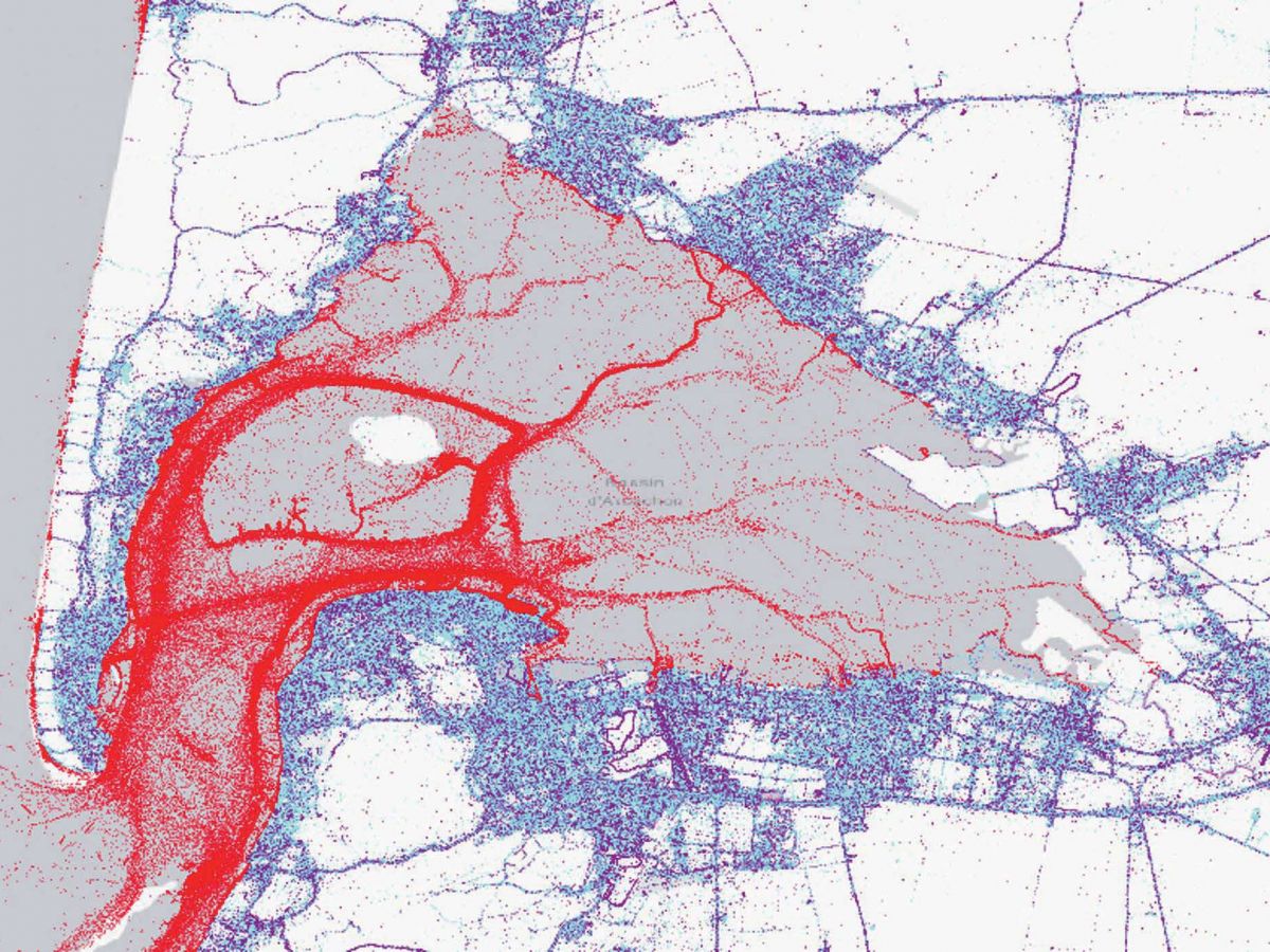
Thanks to geolocation data from mobile phones, a French tech startup has developed a system that can monitor where visitors go, how long they stay, and how densely they crowd certain areas. By analyzing this information anonymously, city planners and environmental managers gain a clearer picture of tourist traffic patterns—down to the hour.
It’s like having a Google Maps heatmap for foot traffic in fragile locations. I remember visiting a small coastal village in southern France last summer. The locals shared that at peak season, their population triples, but no one truly knew how many came or how to manage them. With tools like this, they finally have the numbers to back up their experience—and plan accordingly.
When Too Much Love Hurts a Place
Iconic destinations like Barcelona, Easter Island, and the Porquerolles Islands are no strangers to the downsides of mass tourism: strained infrastructure, disappearing locals, damaged ecosystems. Authorities in these places are increasingly turning to drastic—but necessary—measures: setting visitor quotas, implementing entry fees, or restricting access during certain times of day or year.
In fact, the term “overtourism” didn’t gain mainstream traction until 2017, and it exploded into public discourse after the post-COVID travel rebound. As travelers rushed back to see the world, so too returned the overcrowded streets, long queues, and the delicate balance between welcome and weariness in tourist hotspots.
A Smarter Way to Protect Nature
One of the most promising aspects of this GPS-based tracking approach is its potential to safeguard endangered environments. When applied thoughtfully, the data can guide authorities in identifying stress points in natural reserves, hiking trails, and marine parks. Instead of reacting after damage is done, officials can proactively adjust access and limit harm.
It’s a modern twist on the old-fashioned ranger counting hikers with a clicker at the trailhead—except now, the “clicks” are digital and gathered in real time from thousands of devices.
From Surveillance to Sustainability
To be clear, privacy is a concern. The system in question uses anonymized data, aggregated from millions of devices without collecting personal identities. It’s about patterns, not people. And the insights are invaluable: tourism boards can adjust marketing campaigns, local councils can rethink infrastructure, and conservationists can create more targeted protection strategies.
NASA warns China could slow Earth’s rotation with one simple move
This dog endured 27 hours of labor and gave birth to a record-breaking number of puppies
Think of it this way: just as traffic apps help cities manage congestion, this tool could help the planet manage tourism before it spirals out of control.
A Path Forward for Conscious Travel
With this kind of technology in hand, destinations don’t have to choose between economic vitality and ecological preservation. Instead, they can embrace a more sustainable model of tourism—one that benefits everyone involved, including the planet.
For travelers, too, this is a reminder: our movements leave a footprint, even if we don’t see it. But now, thanks to the devices in our pockets, we might finally be able to measure—and minimize—that footprint in real time.